UNIGIS Projects
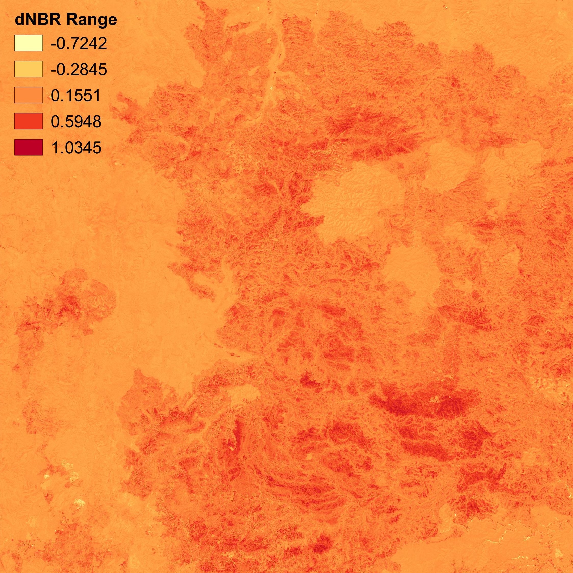
dNBR index during the 2019/2022 in New South Wales, AUS, 2022. UNIGIS coursework for Remote sensing. Made using QGIS.
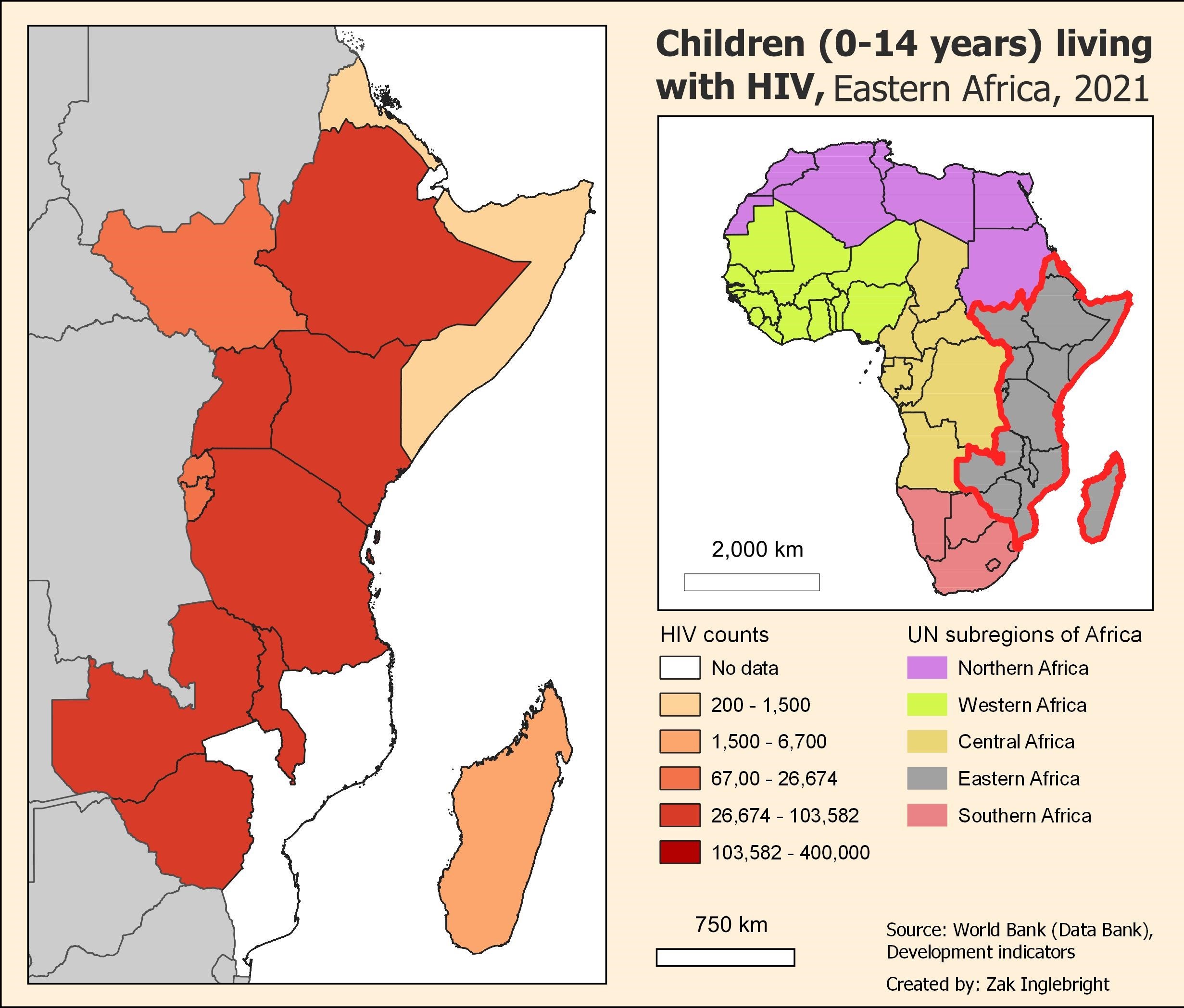
Quanitative choropleth map depicting HIV counts of children (0-14 years) living with HIV across Eastern Africa, 2021. UNIGIS coursework for Cartography. Made using QGIS.

Streamlining and automating data transformation tasks, geographic analysis, and reporting, 2021. UNIGIS coursework for Geographical analysis. Made using ArcGIS FME Workbench.
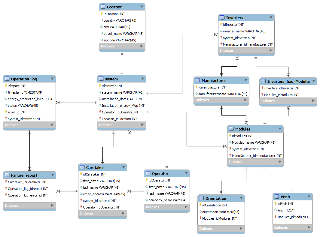
Logical model (entity-related) for a web-based network for documentation of solar power systems and logging operations, 2022. UNIGIS coursework for Geodatabase management. Made using MySQL.
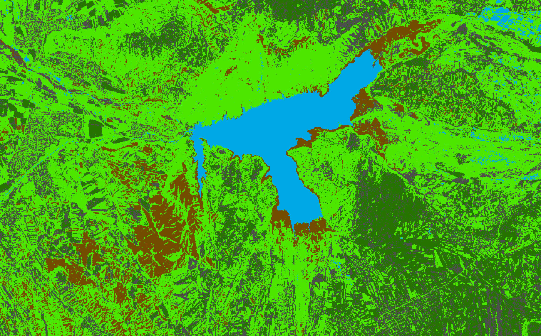
Supervised pixel-based classification, derived from an ASTER image composed of the three VNIR bands: green, red & near infrared. UNIGIS coursework for Remote sensing. Made using ArcGIS Pro.
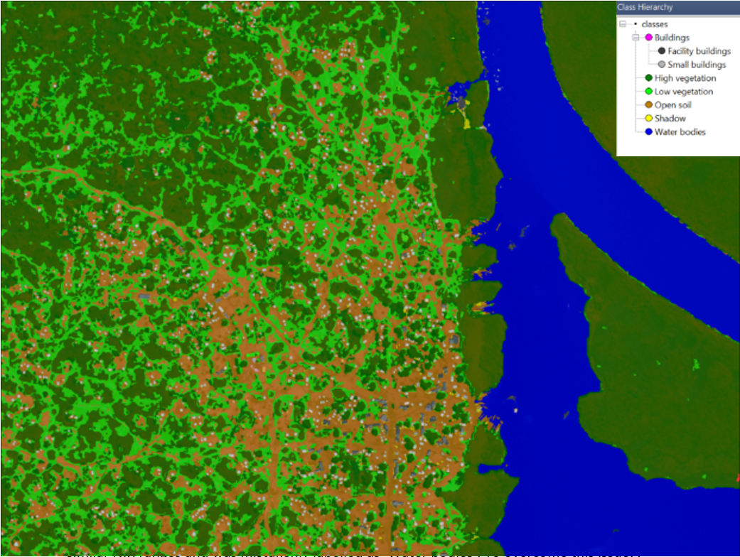
Object-based image classification of the Minkaman settlement in South Sudan, 2014. UNIGIS coursework for Remote sensing. Made using eCognition.
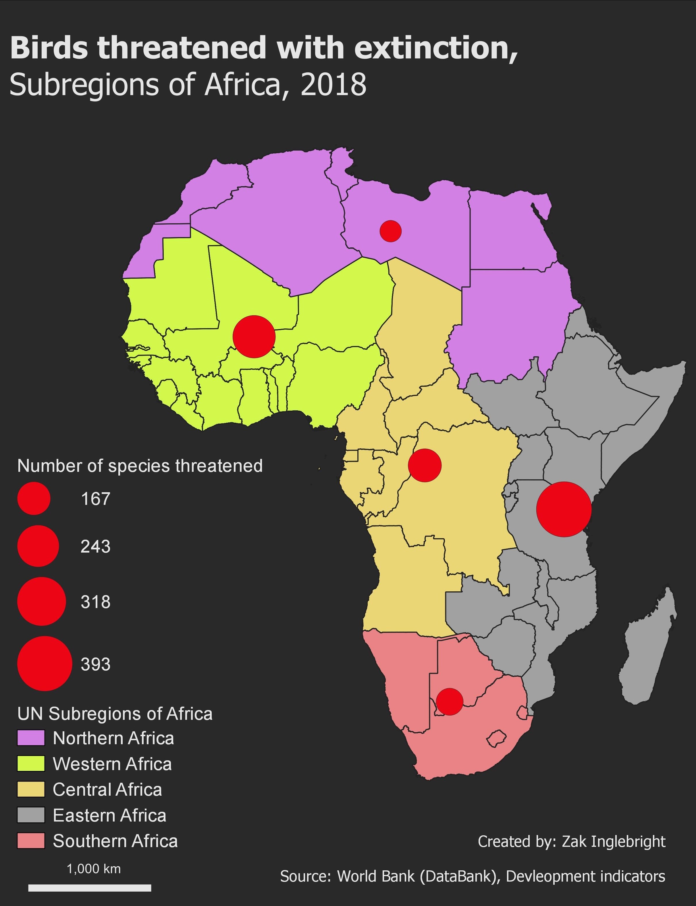
Proportional symbol map, illustrating the number of bird species threatened by extinction across the subregions of Africa, 2018. UNIGIS coursework for Cartography. Made using QGIS.
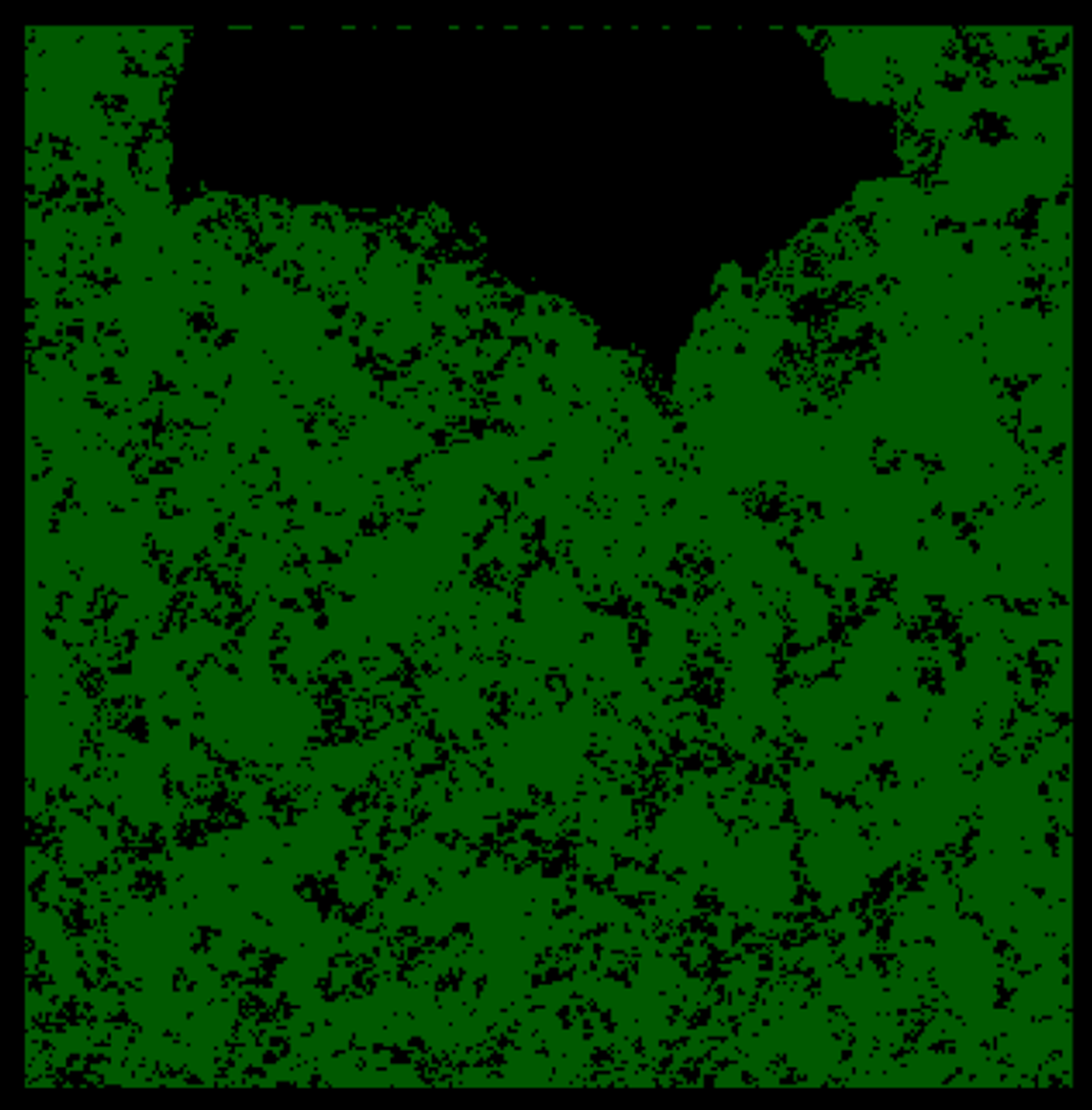
LiDAR derived vegetation mask from unclassified point-cloud data of the Te-Tapui Reserve, NZ, 2019. UNIGIS coursework for LiDAR in theory and application. Made using eCognition.
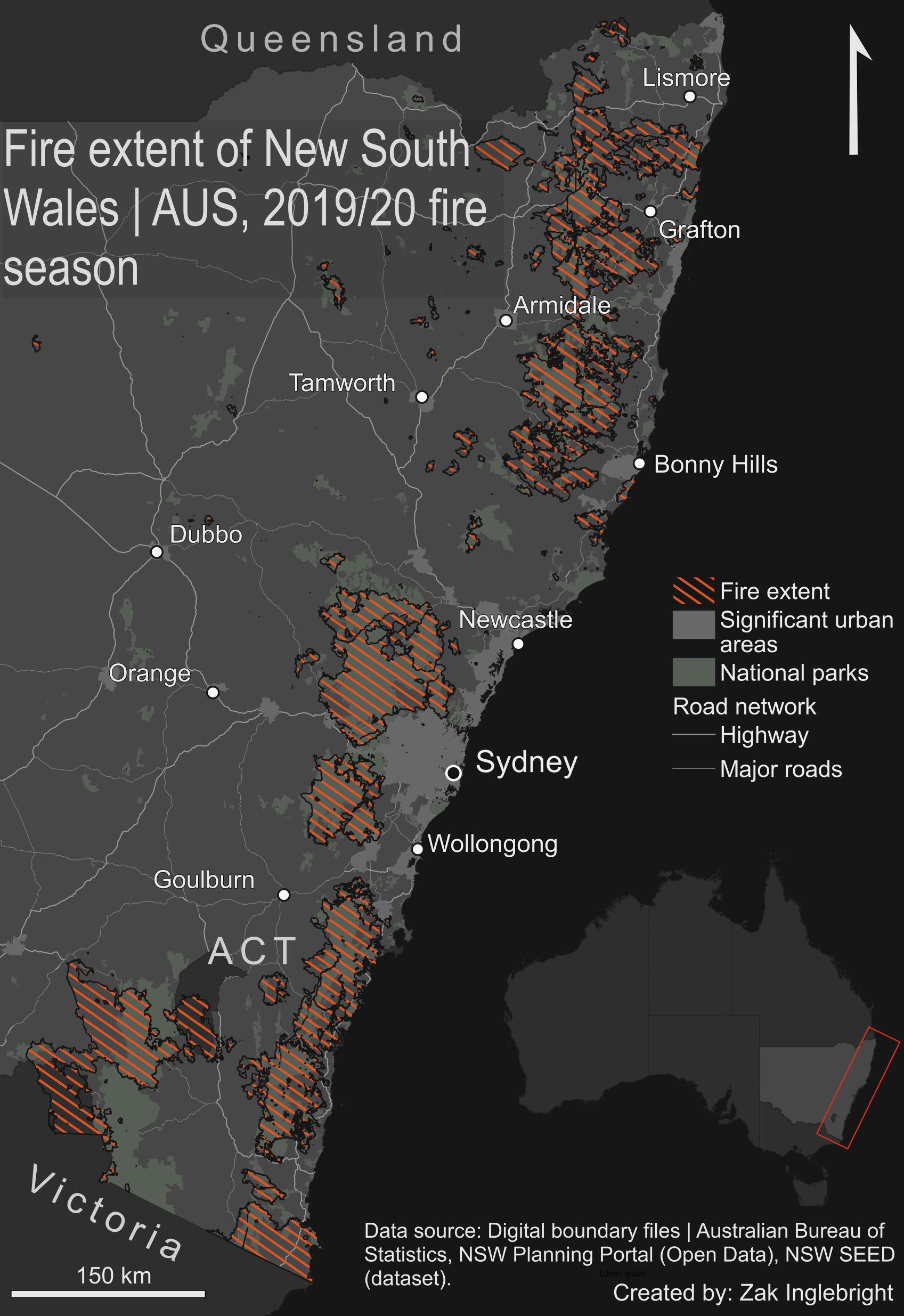
Thematic map, illustrating the extent of wildfires in New South Wales, Aus, during the 2019/20 fire season. UNIGIS coursework for Cartography. Made using QGIS.