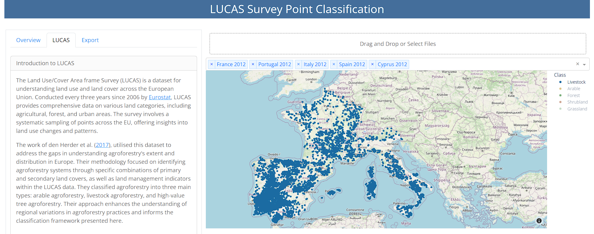
HNEE Projects
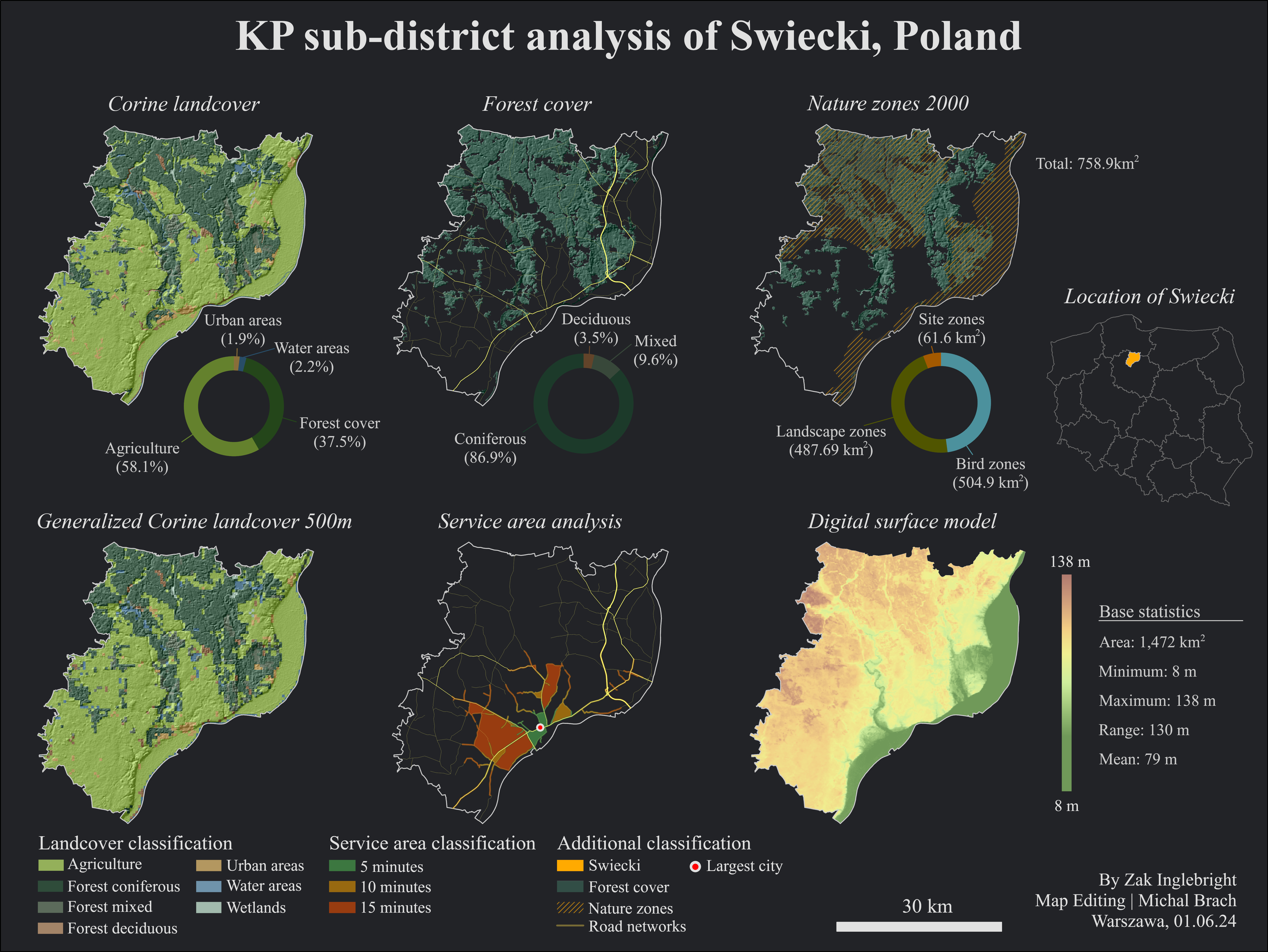
An in-depth analysis of Swiecki, Poland, showcasing landcover types, forest cover distribution, nature zones, generalized landcover, service area accessibility, and digital surface model elevation data. HNEE coursework for Map Editing. Made using ArcGIS Pro.
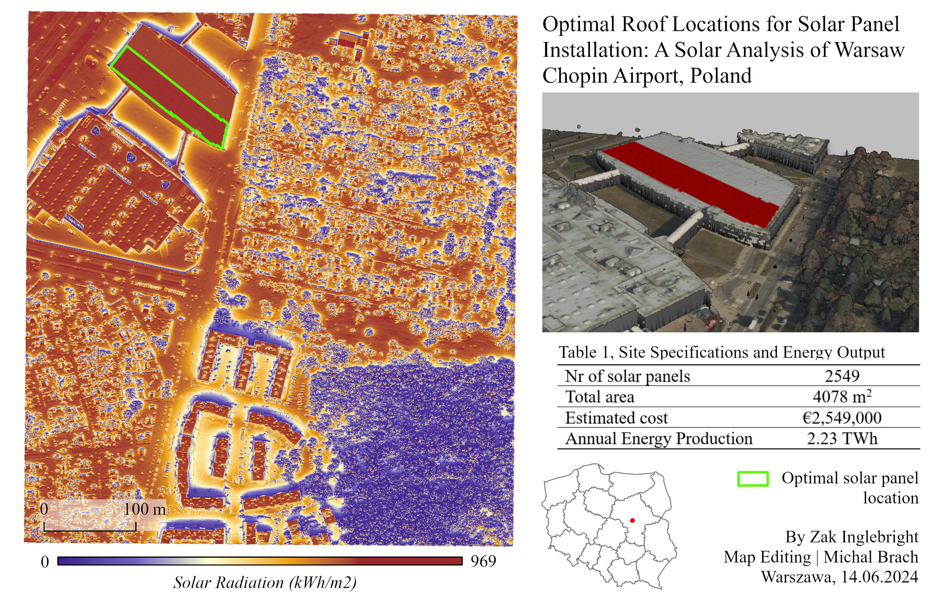
This analysis utilizes LiDAR data to identify the optimal locations for solar panel installation on rooftops at Warsaw Chopin Airport. HNEE coursework for Map Editing. Made using ArcGIS Pro.
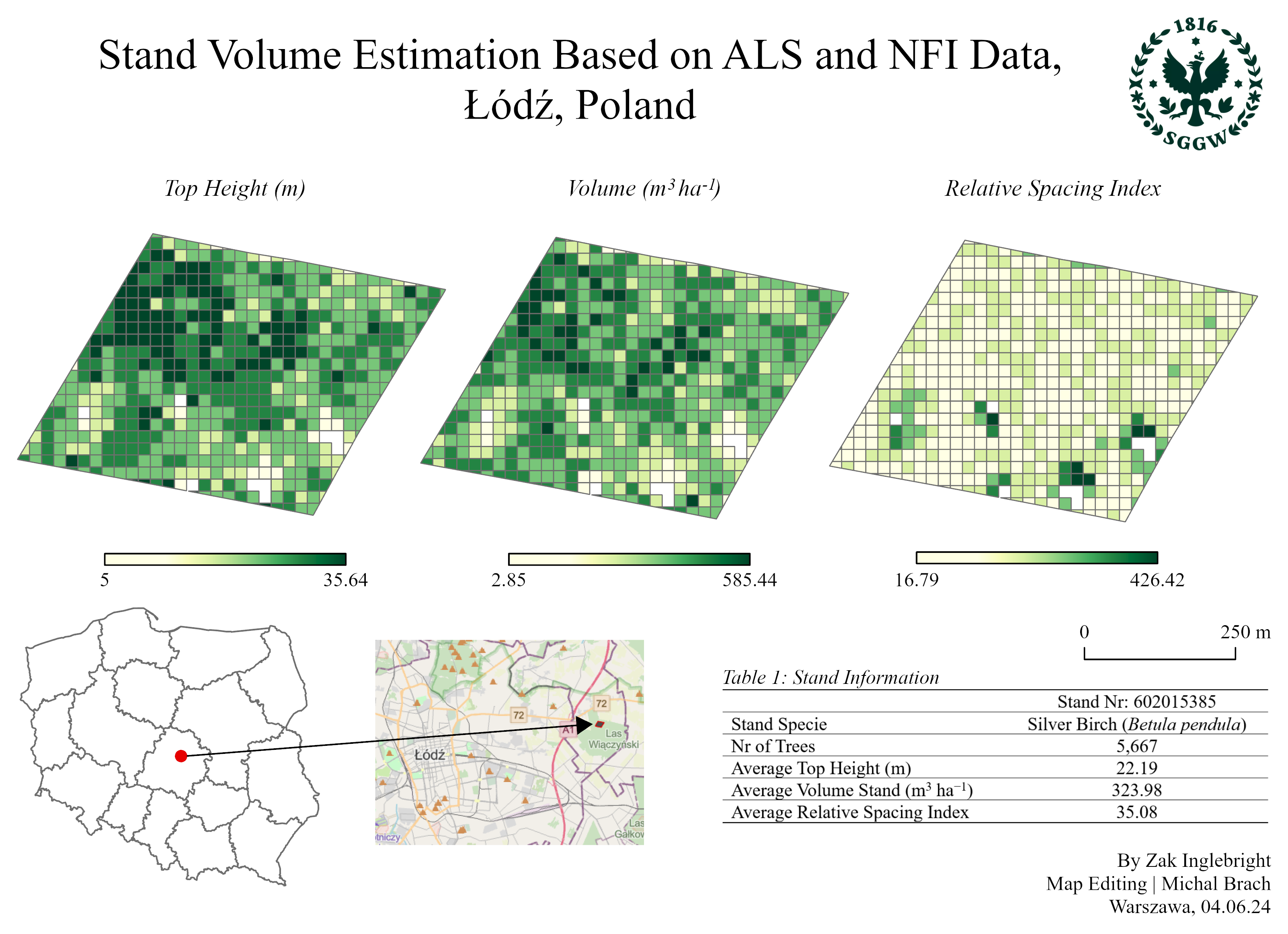
An analysis of forest stand volume using ALS and national forestry inventory data, with preprocessing and calculations performed using R. HNEE coursework for Map Editing. Made using R & ArcGIS Pro.
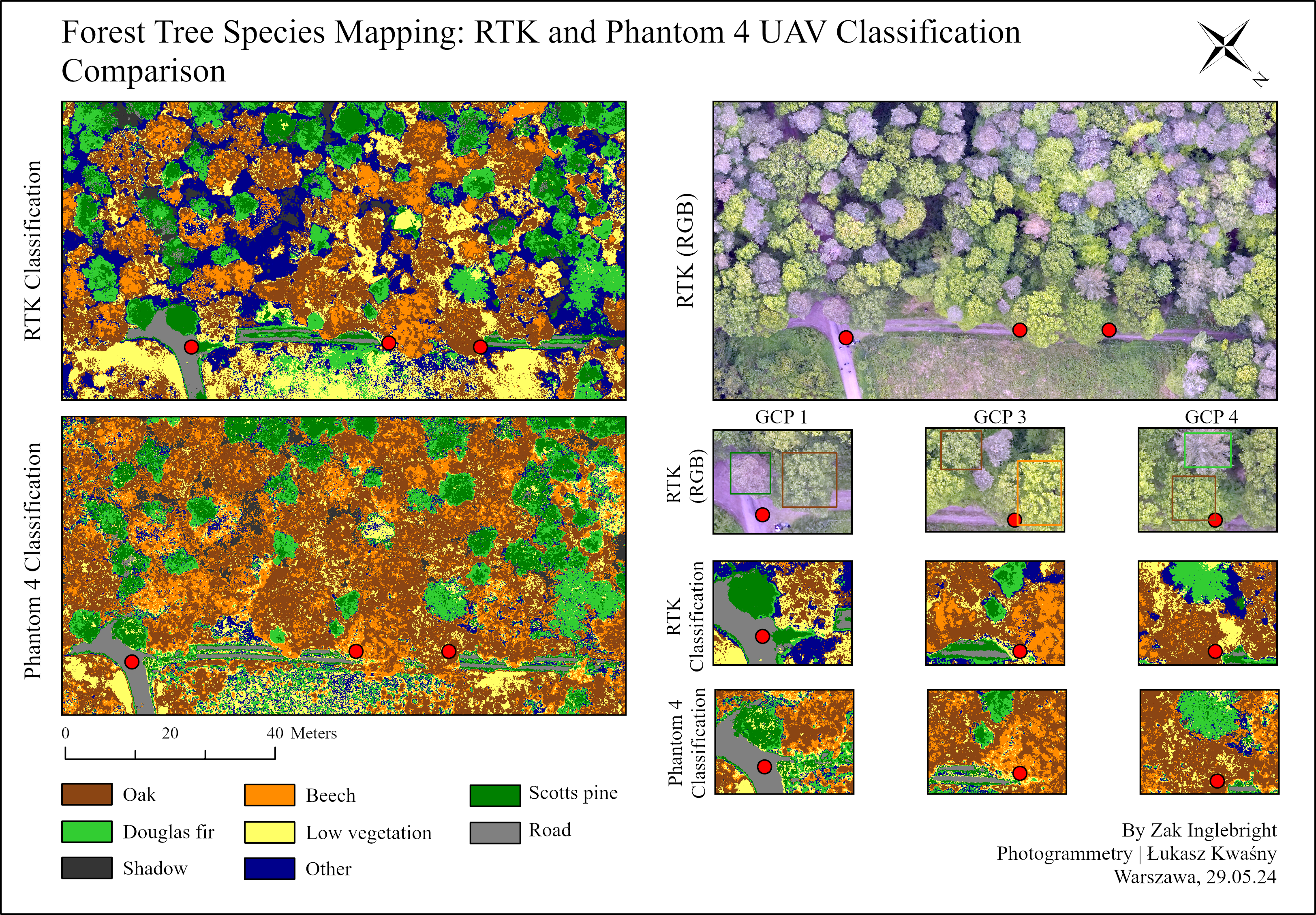
Compares the accuracy of supervised classification for forest tree species mapping using two drones: RTK and Phantom 4 UAV. HNEE coursework for Photogrammetry. Made using ArcGIS Pro.
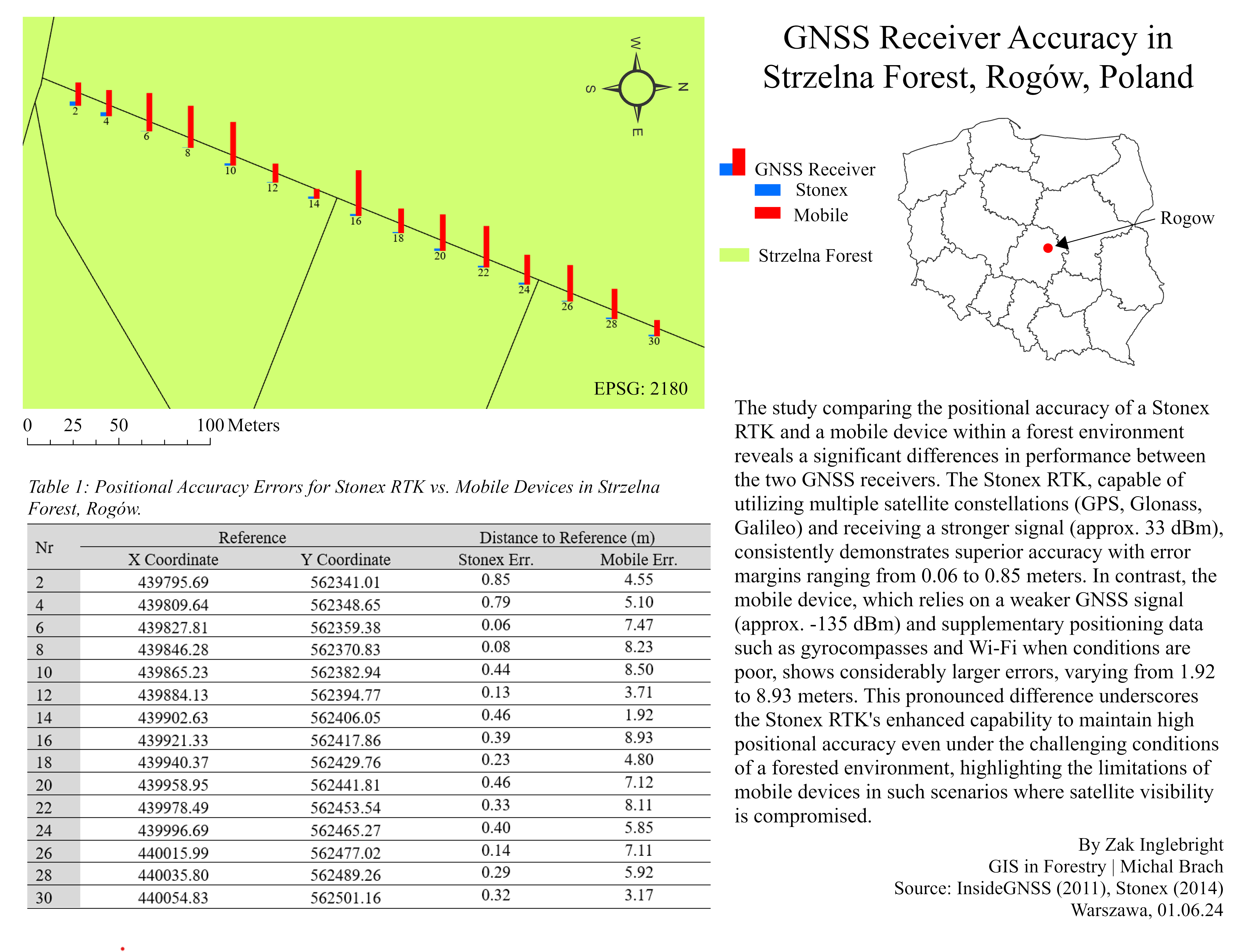
This study compares the positional accuracy of a Stonex RTK and a mobile device within Strzelna Forest of Poland. HNEE coursework for GIS in Forestry. Made using ArcGIS Pro.
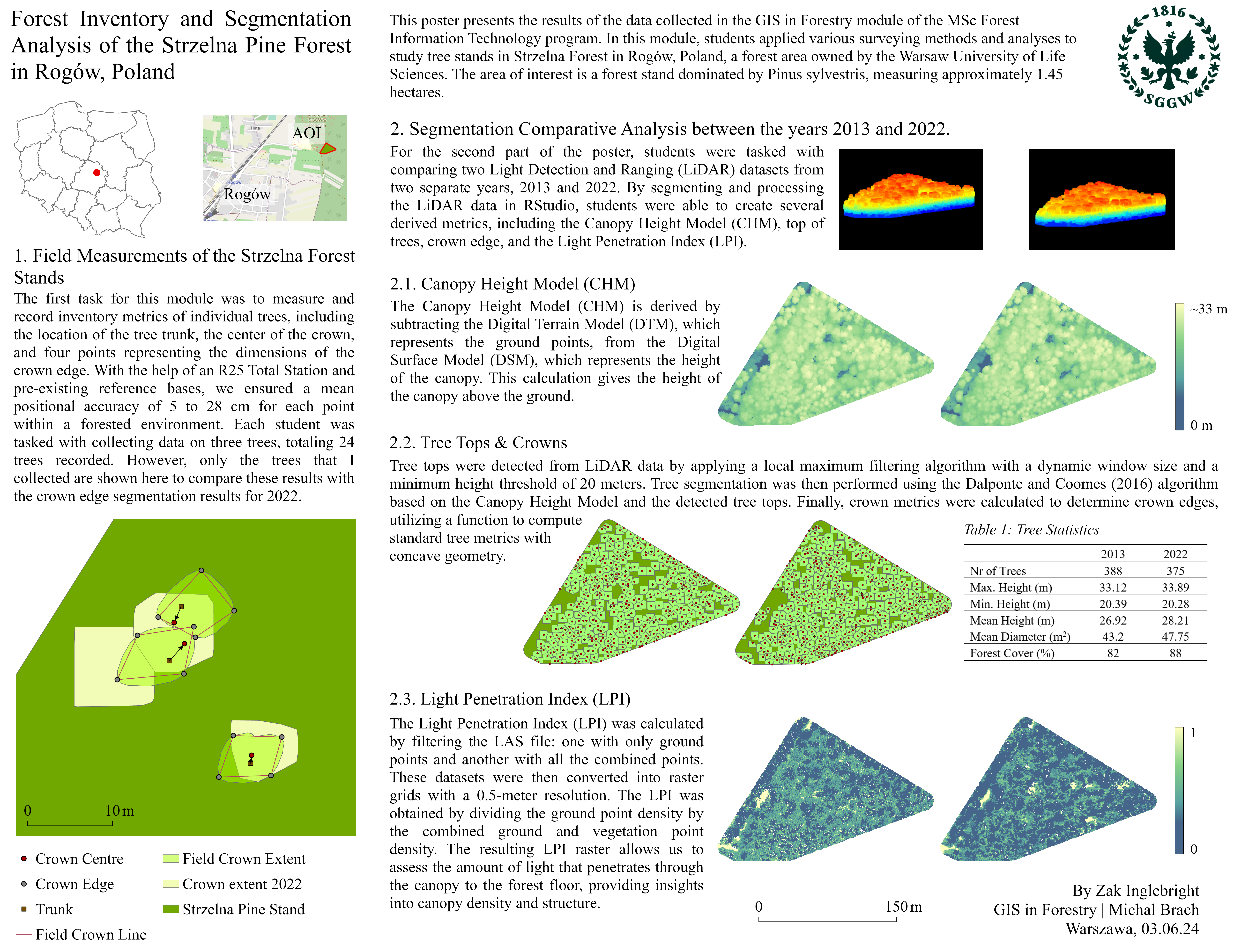
This poster presents a comparative analysis of tree stands in Strzelna Forest, Poland, using field measurements and LiDAR datasets from 2013 and 2022, both processed in R. HNEE coursework for GIS in Forestry. Made using R & ArcGIS Pro.
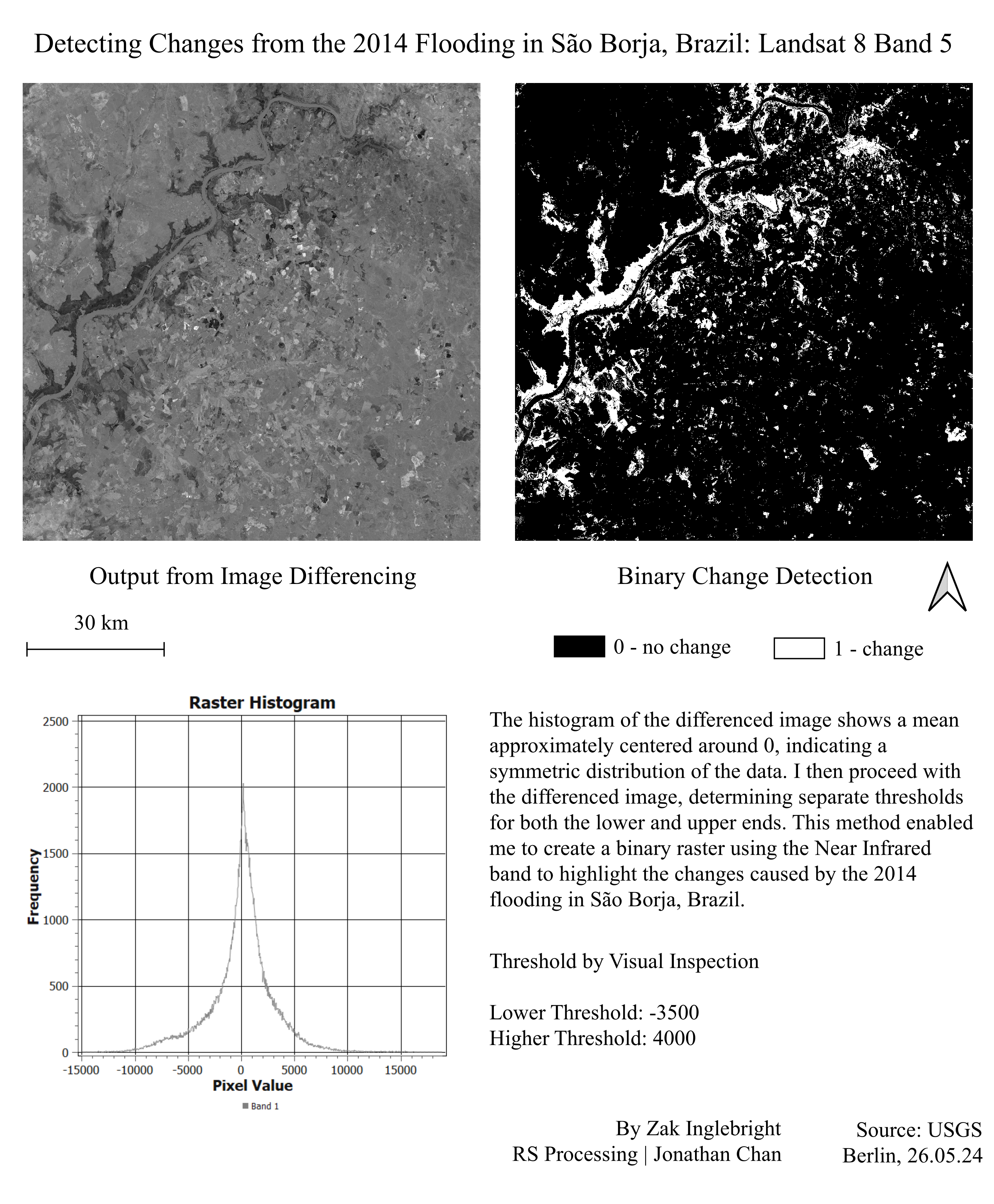
This analysis uses Landsat 8 Band 5 imagery to detect changes caused by the 2014 flooding in São Borja, Brazil. The process involves image differencing, resulting from visual thresholding to highlight areas of change. HNEE coursework for Remote Sensing Processing. Made using QGIS.

This map shows the 2014 flooding impact in São Borja, Brazil, using Landsat 8 imagery and K-means clustering. HNEE coursework for Remote Sensing Processing. Made using QGIS.